Centre releases new map of India
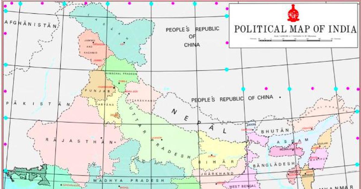
The new political map of the newly released by the Ministry of Home Affairs on November 2. (Photo Courtesy: MHA via PIB India)
Pakistan occupied Kashmir (PoK) areas feature in new political map of the Indian Union released by govt
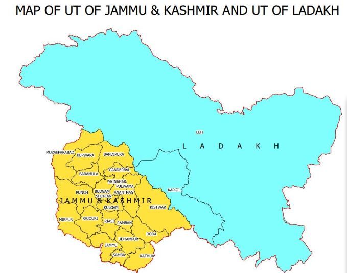
New Delhi, Nov 2 (IANS): Two days after the newly-created Union Territories of Jammu and Kashmir and Ladakh came into being, the government on Saturday released new political map of the Indian Union with 28 states and nine Union Territories (UTs), which surprisingly included territories like Muzaffarabad, Mirpur and Poonch, which are in Pakistan occupied Kashmir (PoK).
The new map denotes the bifurcation of the erstwhile state of Jammu and Kashmir and includes three districts -- Muzaffarabad, Poonch and Mirpur -- which are under PoK.
The Ladakh UT consists of two districts -- Kargil and Leh -- while the Jammu and Kashmir Union Territory comprises 20 districts.
In a gazette notification, the government also enumerated the territories in Leh district as: "Gilgit, Gilgit Wazarat, Chilas, Tribal territory and Leh and Ladakh, except the present territory of Kargil."
The order was called the Jammu and Kashmir Reorganisation (Removal of Difficulties) Second Order, 2019.
The map of J&K UT comprises 20 districts, including Muzzarfarabad, Mirpur and the area of Poonch which are under PoK.
In 1947, the former Jammu and Kashmir state had 14 districts -- Kathua, Jammu, Udhampur, Reasi, Anantnag, Baramulla, Poonch, Mirpur, Muzaffarabad, Leh and Ladakh, Gilgit, Gilgit Wazarat, Chilhas and Tribal Territory.
On the recommendation of the Parliament, President Ram Nath Kovind effectively abrogated Article 370 from the Indian Constitution and issued the Jammu and Kashmir Reorganisation Act, 2019, in August.
On October 31, J&K ceased to exist as a state and was officially bifurcated into two UTs -- Jammu and Kashmir and Ladakh.