Portions of the Paglapahar area came sliding down again, reportedly early in the morning of 12th August 2011 to cause much disruption, damage to vehicles, and a death. This entire stretch of the highway from the Kukidulong Bridge till slightly beyond the Patkai Bridge poses grave threat to all commuters and people living (short or long term) here. In August 2002 huge scale devastation took place in the area (then NH 39) and the consequences were indeed tragic with seven slides being generated during the month on two days (Table). The reason for the mayhem and devastation were two cloudbursts in the hills. A landslide hazard zonation map of the area prepared in 2005 (Figure) depicts the hazard potential. This time again a cloudburst is the culprit.
The section between Chumukedima and Jharnapani along the NH 29 comprises a young geologic terrain with pervious and unstable rocks and soils. This terrain is highly landslide-prone during the monsoon. The major reasons include bedrock and soil condition, steep slopes, and heavy rainfall at the peak of monsoon.
Highway construction and widening have directly or indirectly caused landslides. The Surma, seen as well bedded rocks along the highway, comprise very fine grained sandstone, siltstone, and shale. Though these rocks are comparatively stable, rockslides were initiated at the Patkai Bridge (college end) due to the combined effects of road widening (no mitigation measures in place), rock structure (joint and bedding planes dip toward the road), and heavy rainfall.
The Tipam sandstones lie over the Surma. These sandstones are seen as huge massive rocks, mostly above the highway. The sandstones contain abundant silt and clay and are so friable that they are easily crushed between the fingers. Point load tests of a few rock samples show strengths of 1.03 MPa. Analysis indicates low strengths. This is because of incomplete cementation and compaction at the time of their formation. Hence, these rocks are very porous and permeable leading to their partial weathering to clays, which are occasionally gritty. Because of these characteristics and extensive sheet wash, particularly during cloudburst, major debris flows have occurred along this section. The other major factors in the area leading to landslides, besides rock and soil condition, are the high relief and steep slopes.
Debris flows resembling viscous fluids are especially common in Paglapahar. The material, made up of slurries of soil, rock, and organic matter combined with air and water, flow very rapidly, facilitated by the steep slopes. Most of the landslides in Nagaland have been initiated during intense monsoon precipitation.
Cloudbursts are very common phenomena in this region. Cloudbursts are extremely heavy downpours that usually last for a few minutes. Occasionally they are noted to continue for almost two hours as had happened twice in the Paglapahar area in August 2002. It has been noted that in cases of cloudburst extending for such long durations, large scale devastation occurs. Observation of the phenomena indicates that the damage is worse than that inflicted by the combined effect of rainfall of the whole year.
With adequate weather forecasting abilities and careful analyses of cumulative rainfall patterns it may be possible to predict to some degree the landslide hazards during a particular rainy season. If it appears that an oncoming storm will bring rainfall exceeding the threshold, then the public may be warned of the potential landslide hazards. Those places where sliding has occurred in the past should be closely observed so that lives and property might be saved in the event landsliding.
A study of annual rainfall patterns of parts of Nagaland indicates that most rainfall is received during July and August. This leads to build up of pore pressure in the subsurface due to continued absorption of water through the rainy season, starting from May or so onwards. The pore-water pressure maximum is reached approximately during late July / early August of any given year. Hence, most slides should occur by late July and August. However, landslides do occur during earlier parts of the year which are related to intense monsoon precipitation.
In the Paglapahar area the ground is well saturated by early August. Hence, cloudbursts during this period can have devastating effects, as already observed in 2002 and 2011. Low altitude cumulo-nimbus clouds generated during this season slowly come and get trapped by the high hills of Paglapahar, particularly during the cooler periods such as late evening (August 2002) or early morning (August 2011). Such phenomenon causes cloudbursts that eventually leave a trail of destruction behind.
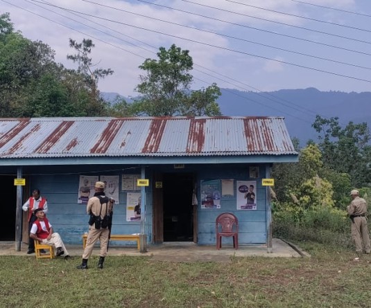
Though most landslides of this area cannot be prevented, their impact on humanity can be minimized through appropriate and timely measures. The time has come to recognize the problems of this dangerous area well beyond routine norms. It would therefore be prudent on the part of the authorities to take necessary measures to check loss to life and property. Firstly, the Nagaland Police Check Gate should be removed and placed at a safer place, away from the steep hills. All other inhabitants in unsafe zones should be asked to evacuate during the danger period. In the event of any sign of an approaching storm from late afternoon onwards, particularly end of July / August, vehicular movement along this section of the highway should be strictly monitored. During the critical period people should be encouraged to travel during daylight hours in this terrain.
Another danger this area poses is that of falling boulders. Therefore, strategically placed signboards to warn drivers will greatly help. Precariously perched boulders along this section should be immediately removed.
The Chathe River is vigorously eroding portions of its banks, including the highway side. Therefore preventive measures to protect against toe erosion should be taken up urgently otherwise bank erosion, though restricted to a few places, will lead to collapse of portions of the already narrow highway.
Department of Geology
Nagaland University
Kohima Campus, Meriema
The section between Chumukedima and Jharnapani along the NH 29 comprises a young geologic terrain with pervious and unstable rocks and soils. This terrain is highly landslide-prone during the monsoon. The major reasons include bedrock and soil condition, steep slopes, and heavy rainfall at the peak of monsoon.
Highway construction and widening have directly or indirectly caused landslides. The Surma, seen as well bedded rocks along the highway, comprise very fine grained sandstone, siltstone, and shale. Though these rocks are comparatively stable, rockslides were initiated at the Patkai Bridge (college end) due to the combined effects of road widening (no mitigation measures in place), rock structure (joint and bedding planes dip toward the road), and heavy rainfall.
The Tipam sandstones lie over the Surma. These sandstones are seen as huge massive rocks, mostly above the highway. The sandstones contain abundant silt and clay and are so friable that they are easily crushed between the fingers. Point load tests of a few rock samples show strengths of 1.03 MPa. Analysis indicates low strengths. This is because of incomplete cementation and compaction at the time of their formation. Hence, these rocks are very porous and permeable leading to their partial weathering to clays, which are occasionally gritty. Because of these characteristics and extensive sheet wash, particularly during cloudburst, major debris flows have occurred along this section. The other major factors in the area leading to landslides, besides rock and soil condition, are the high relief and steep slopes.
Debris flows resembling viscous fluids are especially common in Paglapahar. The material, made up of slurries of soil, rock, and organic matter combined with air and water, flow very rapidly, facilitated by the steep slopes. Most of the landslides in Nagaland have been initiated during intense monsoon precipitation.
Cloudbursts are very common phenomena in this region. Cloudbursts are extremely heavy downpours that usually last for a few minutes. Occasionally they are noted to continue for almost two hours as had happened twice in the Paglapahar area in August 2002. It has been noted that in cases of cloudburst extending for such long durations, large scale devastation occurs. Observation of the phenomena indicates that the damage is worse than that inflicted by the combined effect of rainfall of the whole year.
With adequate weather forecasting abilities and careful analyses of cumulative rainfall patterns it may be possible to predict to some degree the landslide hazards during a particular rainy season. If it appears that an oncoming storm will bring rainfall exceeding the threshold, then the public may be warned of the potential landslide hazards. Those places where sliding has occurred in the past should be closely observed so that lives and property might be saved in the event landsliding.
A study of annual rainfall patterns of parts of Nagaland indicates that most rainfall is received during July and August. This leads to build up of pore pressure in the subsurface due to continued absorption of water through the rainy season, starting from May or so onwards. The pore-water pressure maximum is reached approximately during late July / early August of any given year. Hence, most slides should occur by late July and August. However, landslides do occur during earlier parts of the year which are related to intense monsoon precipitation.
In the Paglapahar area the ground is well saturated by early August. Hence, cloudbursts during this period can have devastating effects, as already observed in 2002 and 2011. Low altitude cumulo-nimbus clouds generated during this season slowly come and get trapped by the high hills of Paglapahar, particularly during the cooler periods such as late evening (August 2002) or early morning (August 2011). Such phenomenon causes cloudbursts that eventually leave a trail of destruction behind.
Though most landslides of this area cannot be prevented, their impact on humanity can be minimized through appropriate and timely measures. The time has come to recognize the problems of this dangerous area well beyond routine norms. It would therefore be prudent on the part of the authorities to take necessary measures to check loss to life and property. Firstly, the Nagaland Police Check Gate should be removed and placed at a safer place, away from the steep hills. All other inhabitants in unsafe zones should be asked to evacuate during the danger period. In the event of any sign of an approaching storm from late afternoon onwards, particularly end of July / August, vehicular movement along this section of the highway should be strictly monitored. During the critical period people should be encouraged to travel during daylight hours in this terrain.
Another danger this area poses is that of falling boulders. Therefore, strategically placed signboards to warn drivers will greatly help. Precariously perched boulders along this section should be immediately removed.
The Chathe River is vigorously eroding portions of its banks, including the highway side. Therefore preventive measures to protect against toe erosion should be taken up urgently otherwise bank erosion, though restricted to a few places, will lead to collapse of portions of the already narrow highway.
Department of Geology
Nagaland University
Kohima Campus, Meriema